Thinking about buying land in Dawsonville but not sure how to judge access, utilities, or what really drives value? You’re not alone. Raw land can look perfect at first glance, then surprise you with access limits, septic issues, or costly utility extensions. In this guide, you’ll learn how to evaluate Dawson County parcels the way pros do, with the exact checks and local resources that matter most. Let’s dive in.
Why access comes first
Legal and physical access determine what you can build, how you bring in utilities, and how lenders and insurers view the property. Start by confirming whether the parcel fronts a public road and who maintains it. Use the county’s interactive GIS to verify road frontage, right of way, and flood layers on the parcel you’re considering. The Dawson County GIS is your fastest way to confirm these basics early in due diligence. You can check parcel layers on the county’s GIS hub at the Dawson County GIS viewer.
If the land uses a private driveway or a private road, look for a recorded access easement and a maintenance agreement. Without a recorded agreement, you may face disputes and unexpected upkeep costs that hurt resale. Dawson County requires a recorded plat for building permits, so confirm plat status early with the county and pull a copy of the deed. Review the county’s permitting guidance for what documents are required by visiting the building permits and planning page.
If the property fronts a state route, expect to apply for a Georgia Department of Transportation (GDOT) driveway permit. GDOT’s rules set sight‑distance, spacing, and design standards for new entrances on state rights of way. This approval can add time and may require traffic or design improvements, especially near GA 400. You can review GDOT’s Regulations for Driveway and Encroachment Control before you write a contract so you can plan a realistic timeline.
Quick access checklist
- Confirm public road frontage in the Dawson County GIS and note who maintains the road.
- For private roads, verify a recorded access easement and a maintenance agreement on the deed/plat.
- If access is onto a state route, budget time for a GDOT driveway permit and possible improvements.
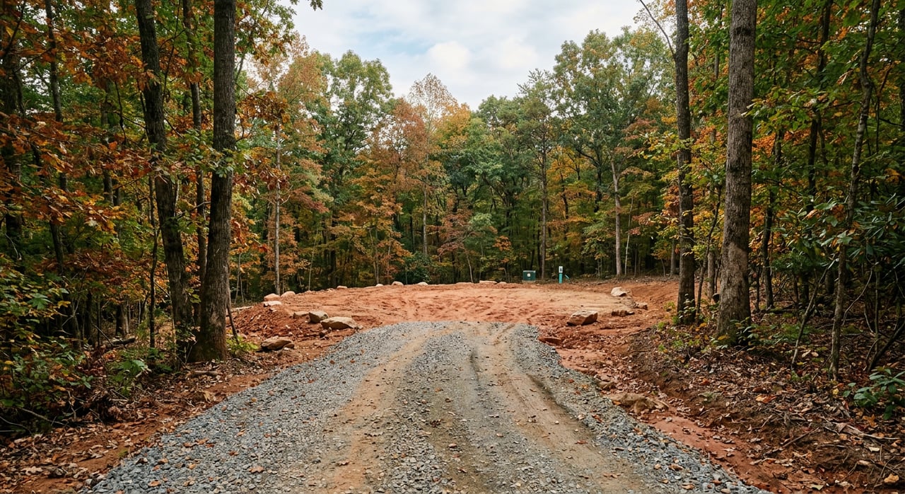
- Walk the approach in person to check heavy‑equipment access, sight distance, and seasonal conditions.
Water, sewer, and onsite systems
Public water and sewer in Dawson County are not universal. City water serves Dawsonville’s municipal area and parts of the county are served by Etowah Water & Sewer Authority. Much of the county still relies on wells and septic. Before you assume municipal water or sewer, confirm the service area with the utility and county planning. If public sewer is within about 200 feet of your lot line or right of way, Georgia rules often require a connection rather than a septic system. For permit and utility contacts, start with the county’s planning and permitting page.
There have been local service‑area disputes between providers in the past, which can affect whether utilities can be extended to a given site. For larger or sensitive projects, verify service boundaries in writing and confirm any required connections or tap fees during due diligence.
Septic permits and soil tests
If a site will use a septic system, Georgia requires a construction permit from the county Environmental Health office. The county will evaluate soils, groundwater, rock, slopes, and absorption to determine system type and placement. Perc and soil evaluations must be completed by certified soil classifiers. You can reach Dawson County Environmental Health for permit steps and timelines at Dawson County Environmental Health, and you can review the state’s On‑Site Sewage Management Systems rules at the Georgia rules page.
Do not rely on a neighbor’s successful septic as proof your lot will pass. Each parcel’s soils and slopes can vary. Schedule soil testing early and write a septic contingency into your offer.
Wells and water planning
Wells are common for rural parcels, but depth to bedrock and yield vary widely in the Piedmont. A licensed well driller or hydrogeologist can estimate feasibility and likely depth. Dawson County Environmental Health is your starting point for well evaluation, sampling, and any required permits.
Power, gas, and internet
Electric service in Dawson County is largely provided by local electric membership cooperatives. Amicalola EMC and Sawnee EMC serve different parts of the county. Line extensions and transformer upgrades can add significant cost if power is not already at the road. Contact the EMC that covers your parcel early for a cost and timeline estimate. You can start with Amicalola EMC to confirm service and learn about extension policies.
Natural gas distribution is limited in many rural areas. Many owners use propane or go all‑electric. If gas is important, confirm whether a distribution line exists near the parcel or plan for a propane supplier.
Broadband access is mixed. Some Dawsonville addresses have cable or fiber, while many rural tracts rely on fixed wireless or satellite. If high‑speed service is a must, verify availability with providers at the exact address before you close.
Site conditions that shape cost
Dawson County’s landscape includes rolling hills with occasional steep ridges. Steep slopes, rock outcrops, and drainage patterns can reduce your buildable area and raise grading, retaining wall, and stormwater costs. Use the county’s GIS to review topography, then order an on‑site topographic survey once you’re under contract.
Soil type affects both your septic design and your foundation. Piedmont soils range from well‑drained to clayey and slowly permeable. Treat any web‑based soil map as a starting point only. Plan for on‑site soil borings or a geotechnical review if you intend a basement or have concerns about shrink‑swell clays or shallow bedrock. Historic USDA soil surveys can provide helpful context, but on‑site testing controls final design.
Floodplains, streams, and wetlands also influence feasibility and cost. Use Dawson County’s GIS to check FEMA/DFIRM flood layers for any mapped hazard zones on the parcel. If potential wetlands are indicated, a federal permitting process may apply. For questions about wetland jurisdiction or Section 404 permits, consult the U.S. Army Corps of Engineers Savannah District’s regulatory program.
Tree cover and conservation encumbrances matter too. Standing timber may have value, but timber rights are sometimes reserved. Conservation easements and utility easements can limit clearing and reduce your buildable envelope. Review title carefully during due diligence and plan a current boundary and topo survey if lines are unclear.
Zoning, permits, and taxes
Every parcel sits in a zoning district that controls minimum lot size, permitted uses, and setbacks. Dawson County’s unified code includes several residential districts with different dimensional standards. Before you make an offer, confirm the parcel’s current zoning and any overlays. You can look up your parcel on the county’s Current Zoning Map and then review the applicable district standards in the county’s code of ordinances.
Building permits are required for new homes and structures, and land‑disturbance and erosion control permits may be needed if you disturb more than 5,000 square feet or more than 1 acre, or if you are near state waters. Expect plan review, code compliance, and inspections. Permit applications must include a recorded plat, so secure that early. You can find submittal requirements and department contacts on the county’s Building Permits page.
Property taxes in Georgia are assessed at 40 percent of fair market value, with local millage rates set by county, city, and school districts. Check the Dawson County Board of Tax Assessors site for the parcel’s current assessed value, tax history, and any special classifications that could affect your holding costs.
What drives land value in Dawsonville
Land values vary widely in Dawson County. Parcels with public road frontage, gentle topography, and easy access to utilities command premiums. Views, curb appeal, and proximity to recreation like Amicalola Falls or the GA 400 corridor also help resale.
On the other hand, steep slopes, wetlands, floodplain, or costly utility extensions can offset a low purchase price. For buyers planning a custom home, a buildable pad with utilities already at the road can be worth a higher price because it cuts months of work and risk. Investors and small developers should quantify utility and grading costs early and compare them to the premium paid for a serviced tract.
Step‑by‑step due diligence checklist
- Confirm legal access
- Pull the deed and recorded plat.
- Ask Dawson County GIS and Public Works if the road is county or state maintained. Start with the Dawson County GIS to verify frontage and right of way.
- Verify zoning and entitlements
- Find the parcel’s district on the Current Zoning Map.
- Review uses, setbacks, and dimensional standards in the county code at the Municode link.
- Check utility availability
- Call county planning or the water/sewer provider to confirm service areas and tap fees.
- For process details and contacts, use the county’s planning and permitting page.
- Prove septic and well feasibility
- Order a soil evaluation with a certified soil classifier and consult Environmental Health.
- Review the state’s onsite sewage rules to understand connection requirements near public sewer.
- Evaluate soils and geotech for foundations
- Plan a geotechnical review if you expect a basement, have steep slopes, or suspect shallow rock.
- Use historic USDA soil surveys for context, then rely on on‑site testing for design.
- Screen for floodplain and wetlands
- Check DFIRM flood layers in the Dawson County GIS.
- If wetlands are likely, consult the USACE Savannah District on jurisdiction and permitting.
- Run full title and easement checks
- Order a title commitment to uncover covenants, easements, and any timber or mineral reservations.
- Confirm any HOA restrictions that could affect site plans.
- Get hard cost numbers
- Request written quotes for driveway cut, grading, utility extension, septic, erosion control, and stormwater measures.
- Compare these to the price premium on parcels already served by utilities.
- Verify taxes and any special classifications
- Pull the parcel record and recent tax history at the Dawson County Board of Tax Assessors.
- Build realistic timelines and contingencies
- Include contingencies for access, soils/septic, utilities, and clear title.
- If you need a GDOT driveway permit, allow extra time for review.
Local buying tips
- Walk the approach. A site that looks fine on a map can be tough for heavy equipment in wet seasons.
- Put utilities in writing. If public water or sewer is a must, get conditional service confirmations during due diligence.
- Respect the slope. Budget for grading and erosion control up front if slopes are moderate to steep.
- Plan your internet. If fiber is essential for work, verify at the exact address before closing.
Ready to evaluate a specific parcel with an appraisal‑minded eye for access, utilities, and true build costs? Get a Dawsonville land consult that blends local knowledge with valuation expertise. Connect with Charles Vecchio to Schedule a Free Local Market Consultation.
FAQs
What permits do I need to build on raw land in Dawsonville?
- You will apply for building permits with Dawson County, and you may need a land‑disturbance/erosion control permit if your project disturbs more than 5,000 square feet or more than 1 acre. A recorded plat is required. See submittal steps on the county’s Building Permits page.
How do I confirm public water or sewer for a Dawsonville parcel?
- Call county planning and the serving utility to verify service area boundaries and tap fees, and use the county’s planning and permitting page for contacts and process details.
Can I install septic if public sewer is nearby in Dawson County?
- Georgia rules often require a sewer connection if a public line is within about 200 feet of your lot line or right of way. Review the state’s onsite sewage rules and confirm with Dawson County Environmental Health.
Who provides electricity to rural Dawsonville lots?
- Local electric membership cooperatives serve most rural areas. Contact the applicable EMC early for extension costs. You can start with Amicalola EMC to confirm service and estimates.
How do I check floodplain or wetlands on a Dawsonville property?
- Review FEMA/DFIRM flood layers on the Dawson County GIS, and if wetlands are suspected, consult the USACE Savannah District about jurisdiction and any required Section 404 permits.
Do I need a GDOT permit for a driveway on GA 400 or a state route?
- Yes. New access on a state route requires a GDOT driveway/encroachment permit that meets sight‑distance and spacing standards. You can review the GDOT Regulations for Driveway and Encroachment Control to plan timeline and requirements.